SATURDAY 24
Overcast skies with periods of reduced visibility. Intermittent snowfall, light to moderate, with expected accumulations of 10–15 cm at the base of the slopes and around 15–20 cm at higher elevations. Irregular accumulations due to wind. Northerly wind, moderate at higher altitudes, especially in the afternoon, generally 14–16 m/s, locally stronger near the summits. Very intense cold, with sub-zero temperatures throughout the day at all elevations of the facilities.
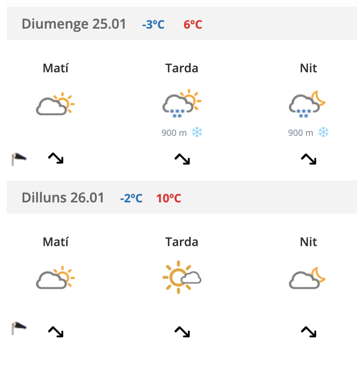
SUNDAY 25
Variable skies, with clouds and some clear spells, especially in the morning. Intermittent snowfall during the night, easing in the morning and around midday, then returning lightly from the afternoon onwards. Periods of poor visibility, with winds from varying directions. Southerly and south-westerly intervals in the afternoon, light to moderate. Temperatures similar to Saturday, close to 0°C at the base of the slopes around midday.
MONDAY 26
Expected improvement in weather conditions during the early morning hours. Snowfall gradually clearing, with increasing sunny spells. Skies becoming variable with a lower risk of precipitation and rising daytime temperatures. Maximum temperatures around 3 to 3.5°C at 1,500 m. Winds somewhat strong from the north and northwest during the night, easing progressively through the morning. Gusts may reach close to 20 m/s at higher elevations between approximately 00:00 and 06:00.